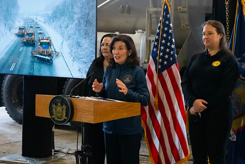
Governor Kathy Hochul today directed State agencies to prepare emergency response assets in advance of a winter storm system expected to bring statewide impacts and heavy rates of snowfall beginning late Thursday night and continuing through Friday evening. The Capital Region and North Country are expected to see the highest snowfall accumulations with the potential for more than a foot of snow. A general 8 to 12 inches of snow is forecast for other parts of the North Country and Capital Region, as well as the Mohawk Valley, Central New York and Finger Lakes Regions. The Southern Tier and Western New York Regions could receive up to 8 inches of snow, while locations in the Mid-Hudson Region could see up to 6 inches.
“Despite the warm weather we experienced earlier in the week, Winter is not quite ready to be over here in New York State and we are preparing for additional snow and ice expected to impact most of the State on Friday,” Governor Hochul said. “I have directed State agencies to prepare and deploy emergency response assets to areas where the greatest impacts from this storm are expected. I strongly urge New Yorkers to avoid driving, if possible, during Friday morning’s commute and pay attention to your local weather forecast for impacts throughout the day.”
New York City and Long Island are expected to receive less snow throughout the event, while freezing rain and ice could impact parts of the lower Mid-Hudson Region, where a tenth of an inch of ice accumulation is expected. Travel conditions on Friday morning could be difficult, where snow will fall at a rate of 1 to 2 inches per hour, causing reduced visibility on roadways.
Starting around midnight Thursday, a band of snow is forecast to develop and move northeast across the eastern Catskills, then shortly after midnight across the Mohawk Valley, Capital Region and Mid-Hudson Valley. By early Friday, snowfall rates of up to two inches per hour are likely near the I-90 corridor. The weather system is expected to shift north of the I-90 corridor Friday morning with a changeover to sleet and/or freezing rain expected for areas south of I-90, and sleet mixed with snow north of I-90. Precipitation is expected to continue through the afternoon before gradually tapering off from west to east by Friday night.
In parts of Western New York and the Finger Lakes regions, rain and snowmelt is causing water levels to rise on local creeks and rivers. Flood warnings are currently in effect with the threat of minor flooding forecast through Saturday evening for some locations.
State Division of Homeland Security and Emergency Services Commissioner Jackie Bray said, “Many parts of the state will experience up to a foot or more of snow over the next 24 hours. Governor Hochul and I want New Yorkers to stay home, if possible, on Friday. We encourage anyone in the path of this snowstorm to prepare emergency supplies now in case of a power outage or inability to travel. Let’s also remember to check on our vulnerable neighbors and loved ones to make sure they can get through the storm safely.”
Multiple weather warnings, watches, and advisories have been issued across the state for a variety of potentially hazardous conditions. For a complete listing of weather alerts and forecasts, visit the National Weather Service website at https://alerts.weather.gov.
Agency Preparations
Division of Homeland Security and Emergency Services
The New York State Division of Homeland Security and Emergency Services’ Emergency Operations Center will be activated this evening to monitor weather and travel conditions, coordinate State agency response operations, and communicate with local governments ahead of and during the event. The State’s stockpiles are prepared to deploy assets to localities to support any storm-related needs, including pumps, chainsaws, sandbags, generators, cots, blankets, and bottled water.
Department of Transportation
The State Department of Transportation is preparing to respond with 3,466 supervisors and operators available statewide. Additionally, 75 Incident Command System personnel are available to support the response as needed.
To support snow and ice activities in critical areas, a total of 42 staff, including 40 plow truck operators and 2 supervisors are being deployed to the Mid-Hudson and Southern Tier regions as follows:
- Mid-Hudson:
-Receiving 8 plow operators from the Finger Lakes
-Receiving 8 plow operators and 2 supervisors from Western NY
-Receiving 8 plow operators from the North Country
-Receiving 10 plow operators from Long Island
- Southern Tier:
-Receiving 6 plow operators from the Mohawk Valley
All staff members are currently preparing for travel and will be in place by Thursday evening before the onset of precipitation. The need for additional resources, including operators, trucks, mechanics and equipment operator instructors, will be re-evaluated as conditions warrant throughout the event.


